|
There, it will become a key component within the EXCELSIOR H2020 EU Teaming project coordinated by the Cyprus University of Technology. The mission of the EXCELSIOR project is to upgrade the existing Remote Sensing & Geo-Environment Lab, established within the Faculty of Engineering & Technology of the Cyprus University of Technology, into a sustainable, viable and autonomous Centre of Excellence, called the ERATOSTHENES Center of Excellence (ECoE).
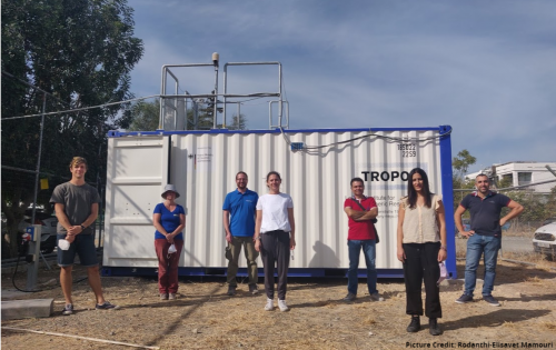
The PollyXT-CYP was funded by the German Federal Ministry of Education and Research (BMBF) via the PoLiCyTa project and will be hosted by the ERATOSTHENES CoE for its permanent operation.
The lidar will link ERATOSTHENES CoE to ACTRIS and PollyNet. Its task will be to document the complex mixture of the different aerosol species and clouds over the Eastern Mediterranean.
TROPOS as an advanced partner in the EXCELSIOR H2020 Teaming Project will coordinate the Climate and Atmospheric Department of the ERATOSTHENES CoE. Under the guidance of TROPOS, ERATOSTHENES CoE scientists will build the Cyprus Atmospheric Remote Sensing Observatory (CARO).
The ERATOSTHENES CoE CARO will consist of two high-tech containers housing state-of-the art PollyXT lidar, doppler lidar, cloud radar and radiometric equipment which will be used to measure the air quality, the dust transport, and the cloud properties over Cyprus. The CARO is planned to become the ACTRIS National Facility of the Republic of Cyprus for Aerosol and Cloud Remote Sensing Observations.
The system is continuously running and since the first observations in Limassol, PollyXT_CYP has been demonstrating the complex aerosol conditions over Cyprus. Between the 27th of October to the 1st of November 2020, the lidar observed smoke plumes from the extreme wildfires on the west coast of the U.S. The smoke travelled over the Atlantic Ocean and triggered the heterogenous ice formation at the height of 10km. Saharan dust was also detected between 2-5km and liquid clouds were formed on the top of the dust layer.
|